
Trenches, cables and inverters on the same map as your tables.
Trenches, cable runs, earthing tape, the fence and roads are routes on the site map, split into short segments; inverters, stations, lamps, gates and culverts are devices. Crews get tasks on them, report them with photos and QC accepts them, as with tables.
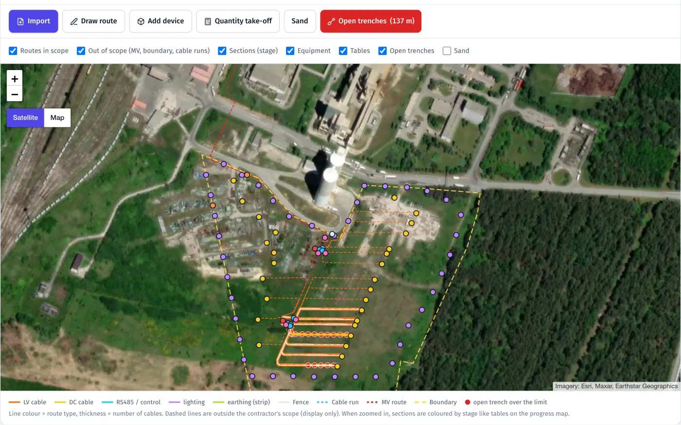
Product screenshots · sample data from a demo project
- ≤ 10 m route segments for tasks and acceptance
- m · m² · m³ quantities from the route profile
- Satellite | Map background on every map
What it does
- 01
Routes and devices as map elements
Trench, fence, road, cable run, MV line and boundary routes; inverters, stations, lamps, connection boxes, gates, culverts, weather stations and masts as devices. Import routes from GeoJSON, KML or DXF, or draw them in the panel.
- 02
Quantities from the profile
Each route has a profile (width, depth, sand layer, warning tape, duct) and contents: which cables and how many. Work quantities per segment come from the rate per metre and the length, ready to compare with the offer.
- 03
Report a segment with photos
A crew reports trench segments with a photo of the start and the end. Tasks, reports, QC and EPC acceptance, protocols and history work on segments and devices the same way as on tables.
- 04
Stages in the right order
Trench, bedding, cables, backfill: each stage waits for the previous one on the same segment, and a stage can require QC acceptance first. The panel shows how many metres are waiting for acceptance and for how long.
- 05
Open trenches and sand
A warning when a trench stays open longer than the project’s limit (3 days by default). Sand volume comes from the trench profile, and FieldSpine proposes drop points along the trench network by truck capacity.
- 06
Layers and background
Show or hide tables, trenches by cable type, fence, road and devices by type, with counts in metres and pieces. Switch any map between satellite and a light map with the project’s roads and buildings, in the panel and in the app.
In the product
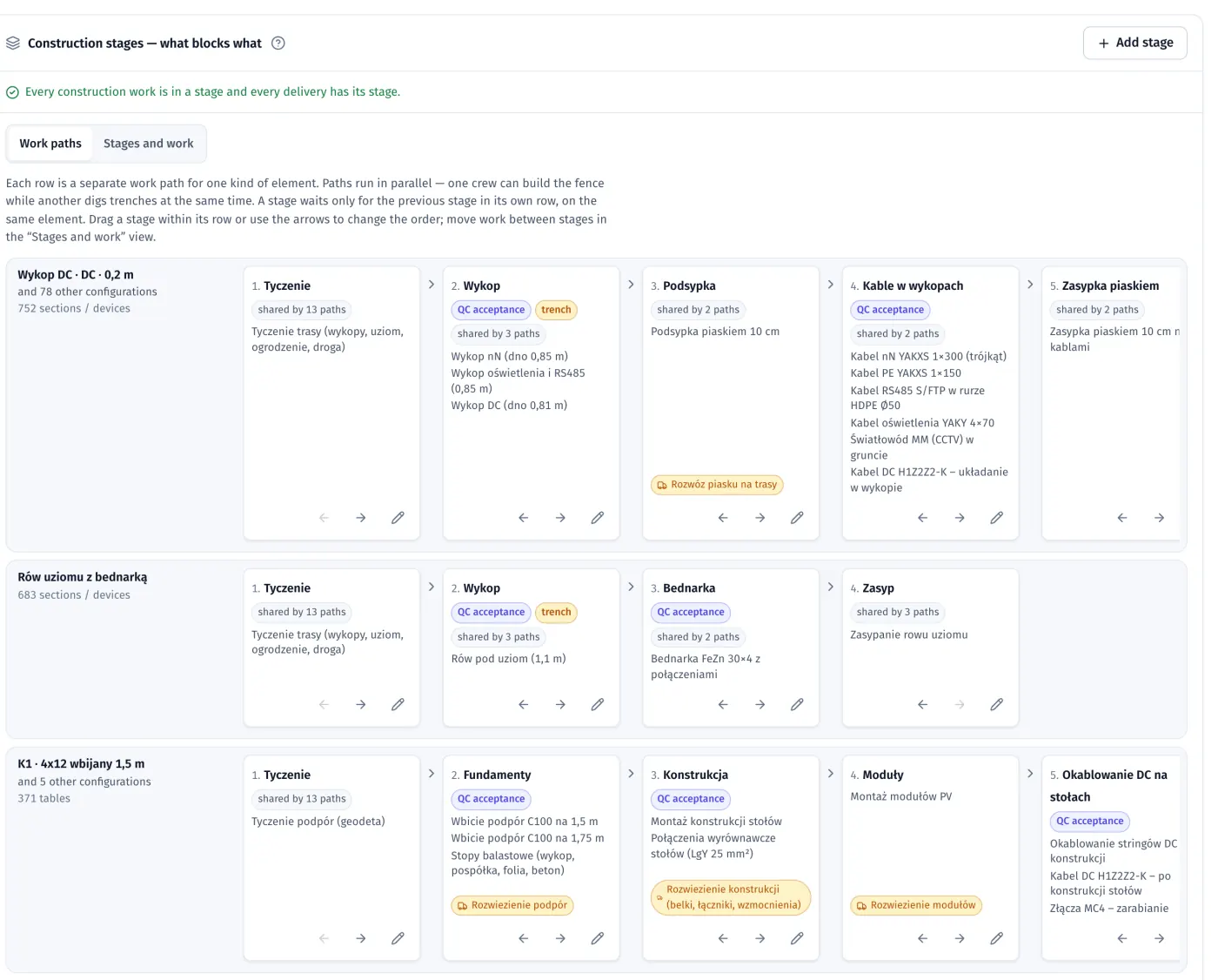
Stage board, “Work paths” view: parallel paths for DC trenches, earthing and tables, stages with QC acceptance and the deliveries before them
Product screenshots · sample data from a demo project
Who uses it
See your own site in FieldSpine.
Send us your table layout file or describe your project. In a 30-minute demo we show you your site in FieldSpine. No commitment.